Urban history in West Van
West Vancouver is home to two National Historic Sites of Canada

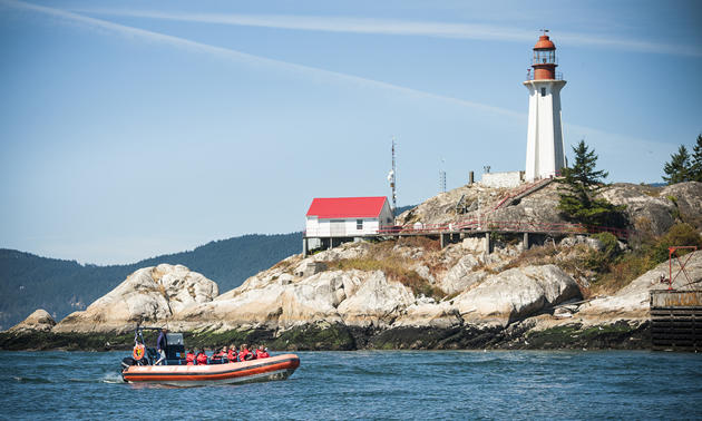
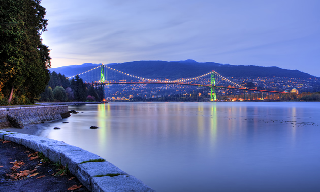
The picturesque, affluent community of West Vancouver, B.C., is built on the slopes of the Coast Mountain Range and is home to two National Historic Sites of Canada (NHS). In 2005, Point Atkinson and the First Narrows Bridge—widely known as the Lions Gate Bridge—were added to the NHS roster.
Point Atkinson, the tip of a rocky peninsula jutting into Burrard Inlet, was so named by Captain George Vancouver in 1792. A lighthouse was built there in 1875, and the 75 hectares of land lying north of the lighthouse now make up Lighthouse Park, a popular place for hikes and picnics. Though the trails can be slippery when wet—as they often are, given that the area is a rainforest—rainy days are some of the best times to visit the park and fully appreciate the old growth Douglas fir, western hemlock, western red cedar, and the silence.
Tens of thousands of people make their way daily from, to or through West Vancouver, crossing Burrard Inlet via the Lions Gate Bridge. The bridge construction was begun in 1937 to provide a link between Vancouver and the North Shore Municipalities, where property developers were eager to build. Construction of the bridge took 20 months, providing much-needed employment at the end of the Depression era. The completed Lions Gate Bridge—a suspension bridge that at the time was the longest of its kind in the world—opened in November 1938.

Lighthouse Park and Point Atkinson are accessed from West Vancouver’s Marine Drive, which begins at the north end of the Lions Gate Bridge. As long as you’re in the neighbourhood and in the mood to absorb some history, you might as well stop and explore Park Royal, which opened in 1950 and was Canada’s first covered shopping mall. It’s located just west of the Lions Gate Bridge on Marine Drive, and occupies close to one million square feet of space.
Be aware that while it's a graceful, welcoming landmark when viewed from a distance on a sunny day, the Lions Gate Bridge in heavy traffic in the rain can be another character entirely. Once you’re across the bridge, you can follow Highway 99—known locally as the Upper Levels Highway—to the Horseshoe Bay Ferry Terminal, Squamish, Whistler and points north.


